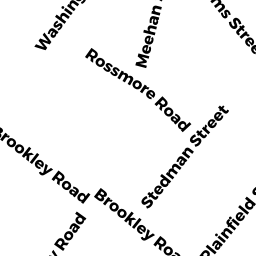
2A Rossmore RD
Owner Information
OAK HILL PARK LLC
320 WASHINGTON ST SUITE 3FF
BROOKLINE, MA 02445


Property Details
2A Rossmore RD is classified as a Mixed Use (Primarily Commercial, some Residential) (Rc: two res units).
The primary structure on this property was built in 1900. There are 7,062ft2 of built area within this property. There is 4,474ft2 of residential/living space within this property.
2A Rossmore RD is valued at $734,600. The land is valued at $174,000 and the structures are valued at $560,600.
The most recent deed for 2A Rossmore RD is recorded at the local registrar in Book 87952, Page 4RL. 2A Rossmore RD was last sold on Tuesday, February 6, 2018 for $1,150,000.
Assessment data from fiscal year 2020.
Flood Data
According to the FEMA National Flood Hazard Layer, this property does not appear to be in a flood zone. It may also be in an area not yet reviewed. Nonetheless, confirm this information prior to taking any action.
To view the flood hazards around this property, create a FEMA "Firmette" Map of the area around 2A Rossmore RD.
Broadband Internet Providers
| Provider | Type | Bandwidth (mbps) | |
|---|---|---|---|
| GCI Communication Corp. | Satellite | 0 | 0 |
| Crown Castle Fiber | Fiber | 0 | 0 |
| Viasat Inc | Satellite | 100 | 3 |
| Verizon New England Inc. | DSL | 5 | 0 |
| Verizon New England Inc. | Fiber | 940 | 880 |
| VSAT Systems, LLC. | Satellite | 2 | 1 |
| HughesNet | Satellite | 25 | 3 |
| Comcast | Cable | 1000 | 35 |
Broadband service provider data from December 2020.